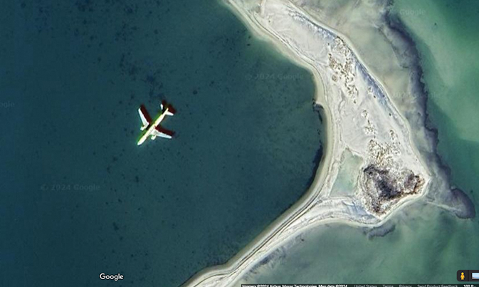
Eagle-eyed reader Tom Orrell pointed this out to the Gazette-Journal—a satellite photo view on Google Maps of Mathews County, dated 2024. He was looking at the Gwynn’s Island area, “then I zoomed in/enlarged the view area of Milford Haven, specifically the Hole in the Wall and Sandy Point area (southernmost tip of Gwynn’s Island). As I kept zooming in for a closer look, I clearly spotted jet airliner sitting in the shallow water just west of Sandy Point,” he wrote. The large plane appears to be resting in the shallow water, “complete with accurate shadowing, and apparently undamaged.” Since we haven’t heard any reports of passenger jets landing in Mathews waters, we assume the satellite just happened to catch a plane as it flew over the county. If anybody hears something different, be sure to let us know....
To view the rest of this article, you must log in. If you do not have an account with us, please subscribe here.


